Skip to main content
Images d’Art
Open menu
Close menu
Home
Languages
En
glish
Fr
ançais
User menu
Sign in
Sign up
Nav social
Facebook
Twitter
Keywords
Museum
Periods
Authors
Technics
Keywords
Advanced search
Keywords
Authors
Philippe-Ernest Kalas [11]
Bieuville [1]
Léon Joseph Florentin Bonnat [1]
Paul Bonnat [1]
Periods
20th century
Locations
musée d'Orsay [11]
Techniques
watercolour
Collections
Maps and plans
Colors
d8dcd6
Keywords
map (city) [11]
public square [2]
town planning plan [2]
French Revolution (1789-1799) [1]
covered market [1]
estate (property) [1]
garden plan [1]
map (geographical) [1]
sketchbook [1]
13
results
Paul Bonnat
,
Léon Joseph Florentin Bonnat
Deux cartes géographiques
Download
Add to favorites
Add to a selection
Philippe-Ernest Kalas
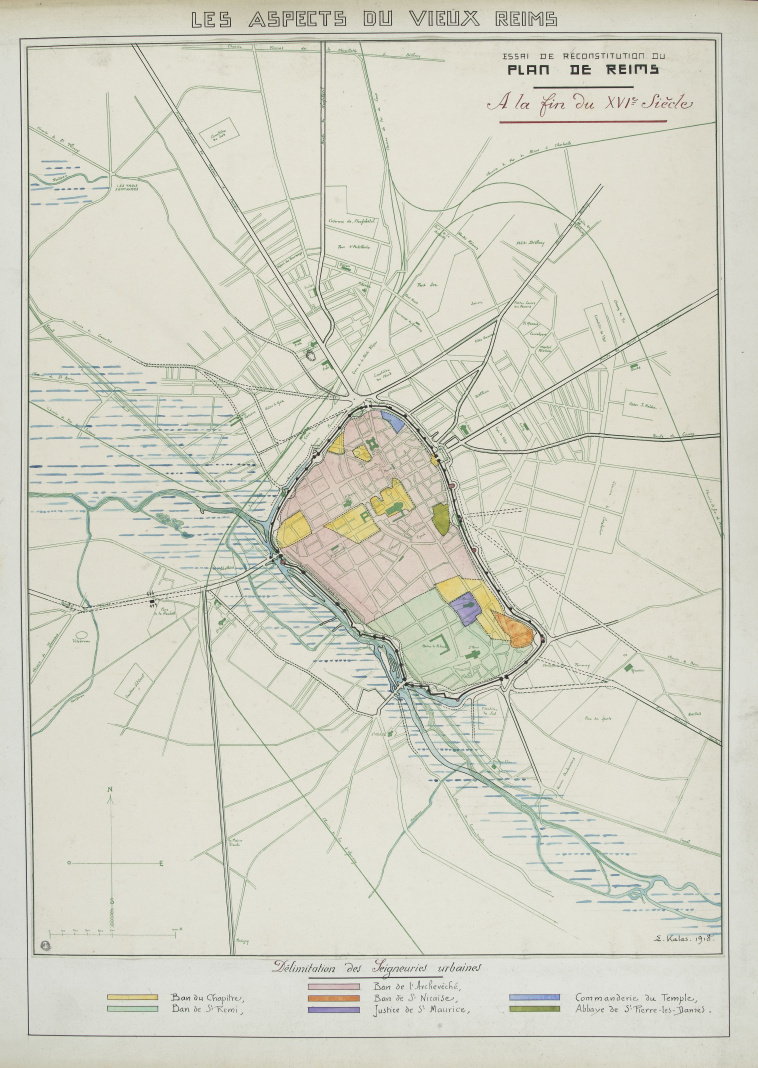
Plan de Reims au 16e siècle
Download
Add to favorites
Add to a selection
Philippe-Ernest Kalas
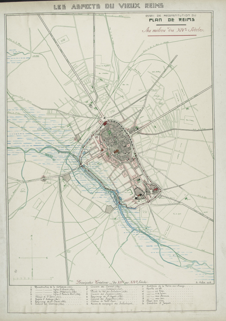
Plan de Reims au 14e siècle
Download
Add to favorites
Add to a selection
Philippe-Ernest Kalas
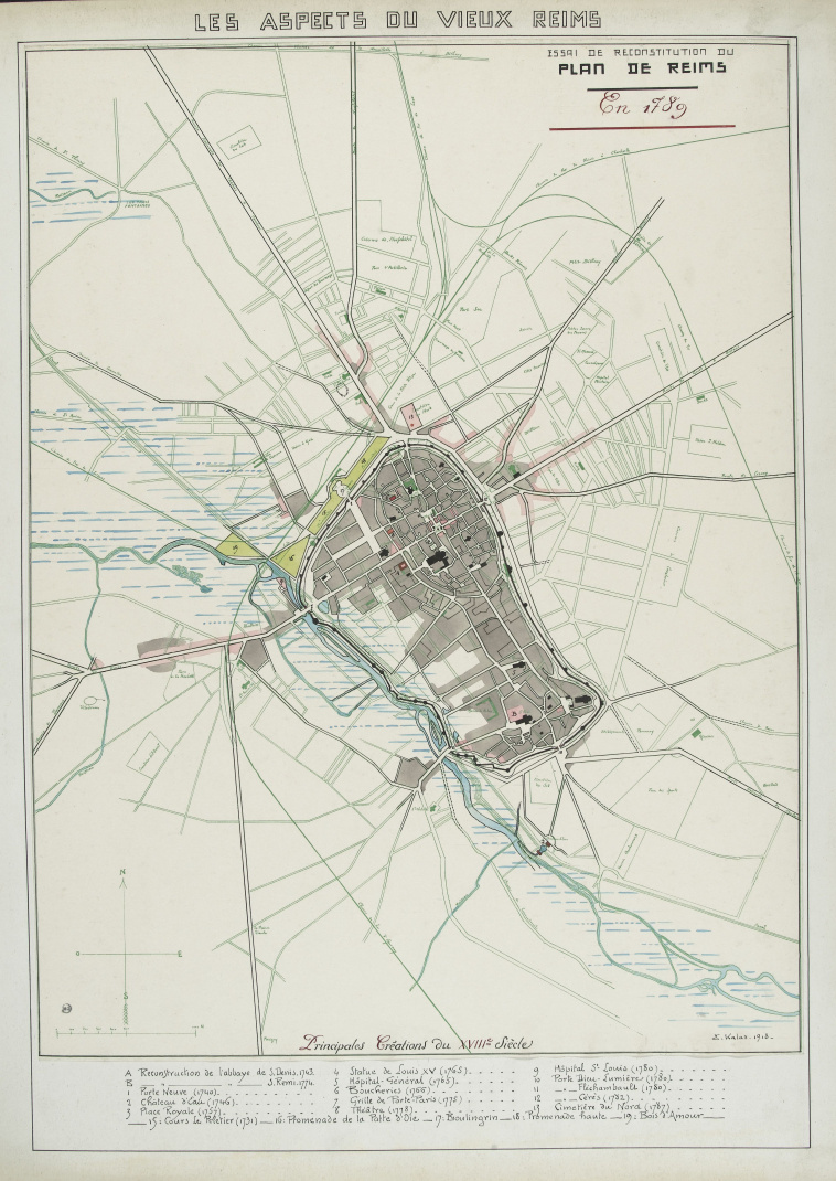
Plan de Reims en 1789
Download
Add to favorites
Add to a selection
Philippe-Ernest Kalas
Plan de Reims au 18e siècle
Download
Add to favorites
Add to a selection
Philippe-Ernest Kalas
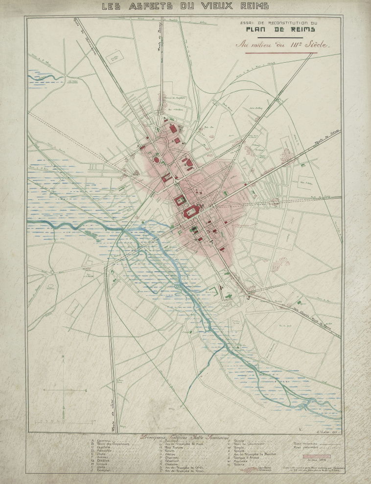
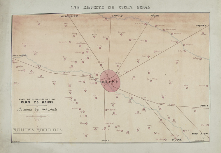
Plan de Reims au 3e siècle
Download
Add to favorites
Add to a selection
Philippe-Ernest Kalas
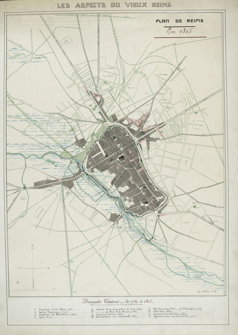
Plan de Reims en 1825
Download
Add to favorites
Add to a selection
Philippe-Ernest Kalas
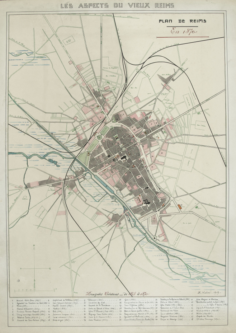
Plan de Reims en 1870
Download
Add to favorites
Add to a selection
Philippe-Ernest Kalas
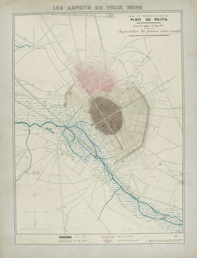
Plan de Reims sous le règne d'Auguste
Download
Add to favorites
Add to a selection
Philippe-Ernest Kalas
Plan de Reims au 3e siècle
Download
Add to favorites
Add to a selection
Philippe-Ernest Kalas
Ville de Reims : projet de plan régulateur et d'extensions : quartier de l'ancien marché
Download
Add to favorites
Add to a selection
Philippe-Ernest Kalas
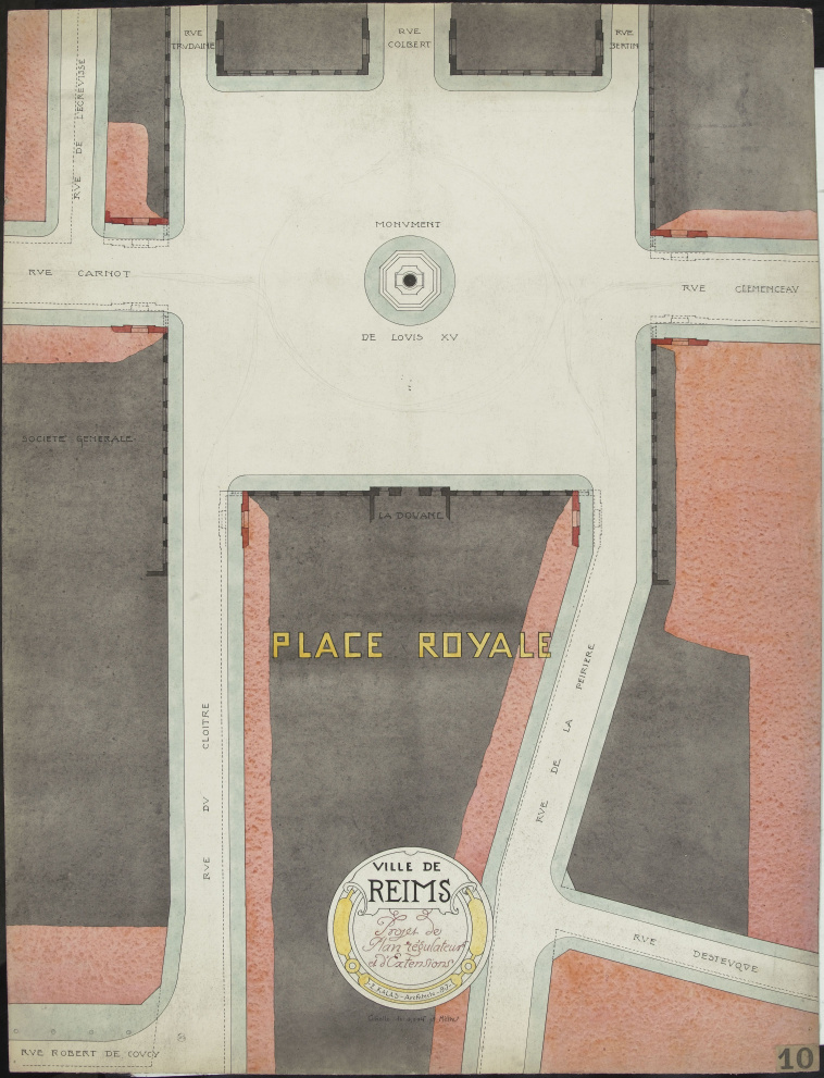
Ville de Reims : projet de plan régulateur et d'extensions : place Royale
Download
Add to favorites
Add to a selection
Bieuville
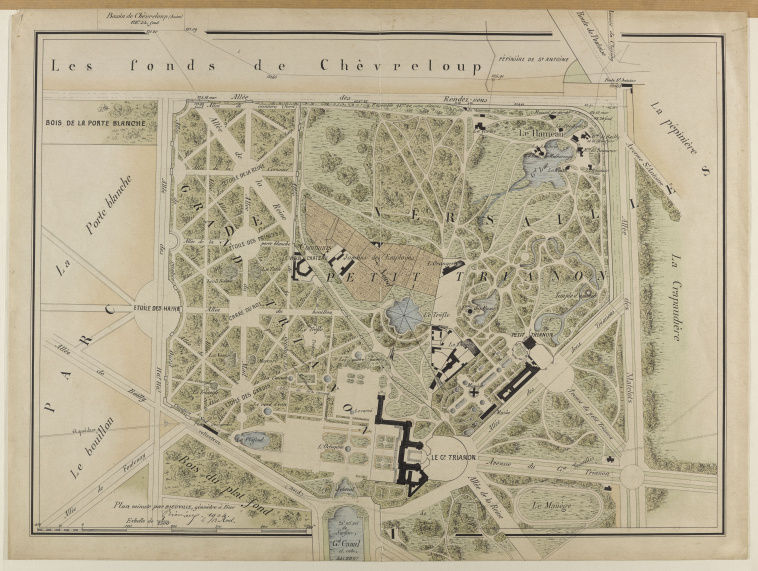
Plan du domaine du Grand Trianon, du Petit Trianon, du Hameau de la Reine dressé en avril 1904
Download
Add to favorites
Add to a selection