Skip to main content
Images d’Art
Open menu
Close menu
Home
Languages
En
glish
Fr
ançais
User menu
Sign in
Sign up
Nav social
Facebook
Twitter
Keywords
Museum
Periods
Authors
Technics
Keywords
Advanced search
Keywords
Authors
Nicolas Ozanne [2]
Bieuville [1]
Johan Barthold Jongkind [1]
Nicolas Lallemant [1]
Philippe-Ernest Kalas [1]
Periods
19th century [3]
modern age [3]
18th century [2]
20th century [2]
XIXth century [2]
XVIIIth century [2]
XXth century [2]
17th century [1]
XVIIth century [1]
contemporary period from 1789 until 1914 [1]
Locations
musée du Louvre [2]
musée Condé [1]
musée d'Orsay [1]
Techniques
watercolour
Collections
Maps and plans
Colors
ada587
Keywords
map (geographical) [3]
garden plan [2]
map (city) [2]
English army [1]
Spanish army [1]
War of the League of Augsburg (1689-1697) [1]
estate (property) [1]
history of South America [1]
naval battle [1]
reign of Charlemagne (768-814) [1]
8
results
Nicolas Lallemant
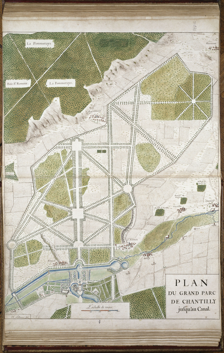
Plan du Grand Parc de Chantilly jusqu'au canal, tiré du recueil "Terres de Bourgogne, Berry etc".
Download
Add to favorites
Add to a selection
Bieuville
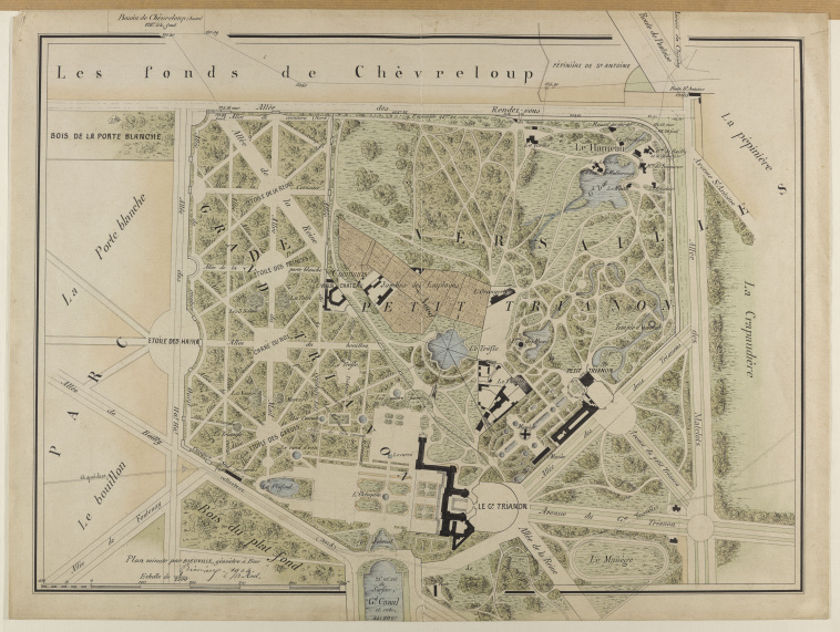
Plan du domaine du Grand Trianon, du Petit Trianon, du Hameau de la Reine dressé en avril 1904
Download
Add to favorites
Add to a selection
Johan Barthold Jongkind
Carte de la région parisienne
Download
Add to favorites
Add to a selection
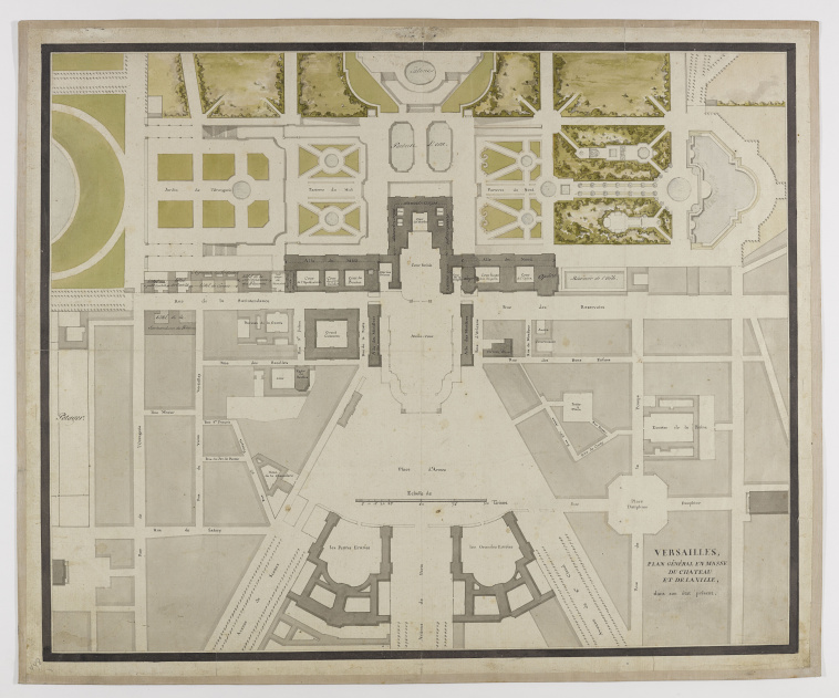
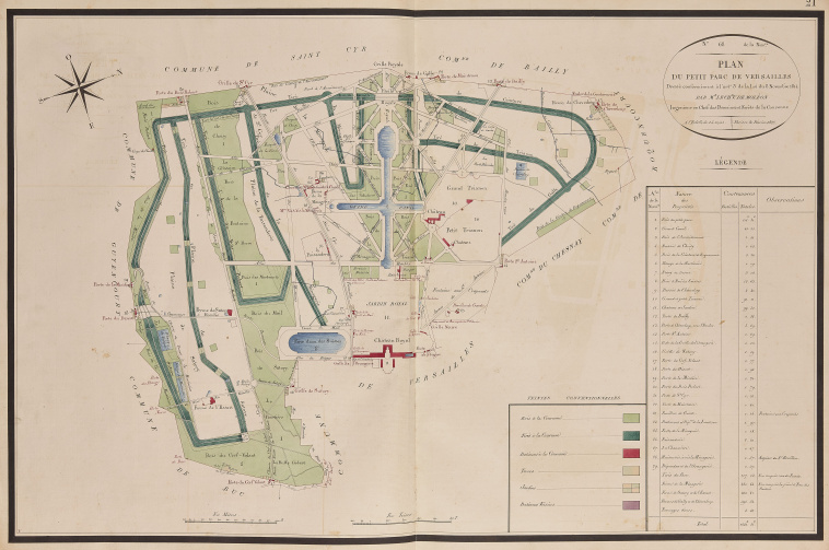
Plan général en masse du château et de la ville de Versailles
Download
Add to favorites
Add to a selection
Nicolas Ozanne
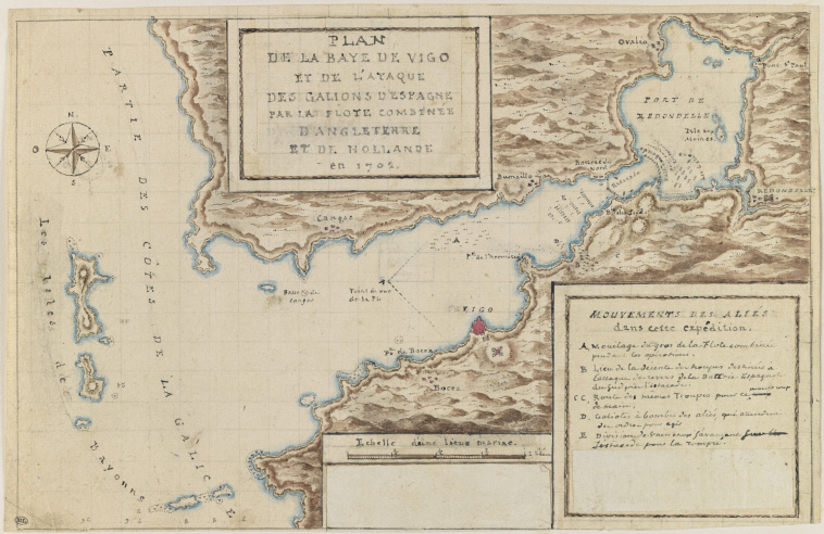
Plan explicatif de l'attaque des galions dans la baie de Vigo, 1702
Download
Add to favorites
Add to a selection
Nicolas Ozanne
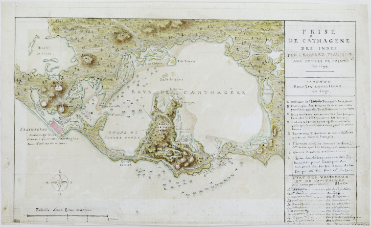
Carte et plan explicatifs de la prise de Carthagène en Amérique, en 1697
Download
Add to favorites
Add to a selection
Philippe-Ernest Kalas
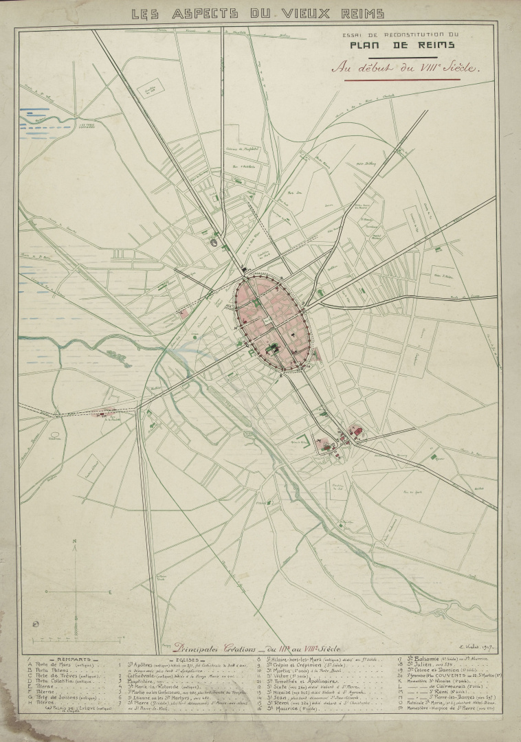
Plan de Reims au 8e siècle
Download
Add to favorites
Add to a selection
Atlas matrice de la Division de Versailles - Mr De Moléon - Ingénieur de la Couronne - 1825
Download
Add to favorites
Add to a selection